Vancouver International Airport (YVR)
Driving Directions / Travel by Car
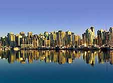
(Vancouver, British Columbia - BC, Canada)
Vancouver International Airport (YVR) serves destinations in the southwest of Canada and is situated about 13 km / 8 miles from downtown Vancouver.
Routes through to the airport are uncomplicated and well signposted.
The airport can be reached from most directions and is located on the east coast, close to the Richmond area, which lies to the south.
Directions to Vancouver International Airport (YVR) from the north:
- Follow signs for Highway 99 south
- Head south along Granville Street, crossing the Arthur Laing Bridge
- Continue along Granville Street onto Grant McConachie way until reaching the airport
Directions to Vancouver International Airport (YVR) from the south:
- Head north on Highway 99, exiting at Bridgeport Road
- Turn left at the traffic lights on Bridgeport Road
- Continue west along Bridgeport Road until reaching the Airport Connector, which leads directly to the airport
Directions to Vancouver International Airport (YVR) from the west:
- Take Highway 7 westbound to Brunette Avenue
- Follow Brunette Avenue until it joins Columbia Street, New Westminster
- Continue along Columbia street westbound until reaching S.E. Marine Drive
- Follow S.E. Marine drive westbound until reaching the Arthur Laing Bridge
- Cross over the Arthur Laing Bridge and follow Grant McConachie Way to the airport
Road conditions to the airport are generally good, but bear in mind that Vancouver is a busy city and during rush hours, roads have the potential to experience congestion. When driving to Vancouver International Airport, always allow extra time in your travel schedule for unforeseen delays, as a direct result of adverse motoring conditions.
Vancouver International Airport (YVR): Virtual Google Maps
